Wouldn’t it be nice if geospatial data analyses were all in one: easy, fast and effective? Well, that’s possible. And trust us, you don’t need to be a mathematical genius or have superpowers. If you do – that’s great, we’re jealous! If not, we have some good news.
At Globema we’re aware about the challenges faced by companies operating commercial networks (stores, customer service offices, etc.). First, you need to know everything about your subsidiaries location, their surroundings (any competitors around?) and the potential location of new branches. You might wonder what superpowers do we use to get such information in a user-friendly form? The answer is simple – the latest version of our GeoMarketing application, built on top of Google Maps.

Google Inc. research shows that about 80% of data collected by companies has hard to capture spatial context. “Flat sheets” with many columns are difficult to analyze and process. Because of that, for example, evaluating potential locations of new subsidiaries, is complicated, time-consuming and inefficient. Showing data on a map changes everything. And this is where GeoMarketing comes in handy. However, such visualizations are only the tip of the iceberg. Our application provides the means to conduct business and geospatial analyses and supports you in making important business decisions, like: finding the best location of new subsidiary or indicating which units should be closed.

Selected benefits:
- easier access to datasets, both commercial and free
- fast and easy visualization of Big Data with Google Maps
- more accurate business decisions
- simple and intuitive Google Maps interface allows preparing and publishing analyses by any person and in accordance with current business needs (assistance of GIS, IT specialists or even graphic designers not required).
New version of GeoMarketing allows you to:
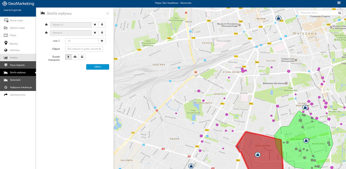
- determinate catchment areas based on time needed (taking into account traffic data/estimations) to access given point
- visualize your own data and other datasets (e.g. data warehouses sourced) directly on Google Maps
- perform spatial analysis based on area and attribute filtering – from the large scale, like the whole country, up to smaller points – single addresses or buildings
- use different types of data (structure and income of the population, administrative boundaries, etc.) in analyses and visualizations supporting decision making process (finding the location for new subsidiary, assessing the local market potential, finding “white spaces” or analyzing external and self-competition)
- share analyses results on a map as printable files, ready-to-use in presentations, offers etc.
Want to see GeoMarketing in action? Register for a live demo


