We’re thrilled to introduce the latest version of our GIS platform, GeoGrid 1.6! This update is designed to improve your workflow with enhanced integrations, smarter data visualization options, and new automation features. Discover how GeoGrid 1.6 makes your work faster, more efficient, and more insightful.
Google Maps and Services
GeoGrid 1.6 now integrates seamlessly with the Google Maps Platform, the world’s most popular mapping solution.
Google Maps: Select Google Maps as your primary background map and choose from default, terrain, or satellite views. Starting now, Google Maps is GeoGrid’s recommended default.
Google Services: Access a range of Google Maps Platform features directly within GeoGrid, including:
- Places – quickly search for locations and addresses.
- Geocoding – convert addresses into precise geographic coordinates.
- Elevation – retrieve terrain elevation data.
- Directions – calculate routes between multiple points.
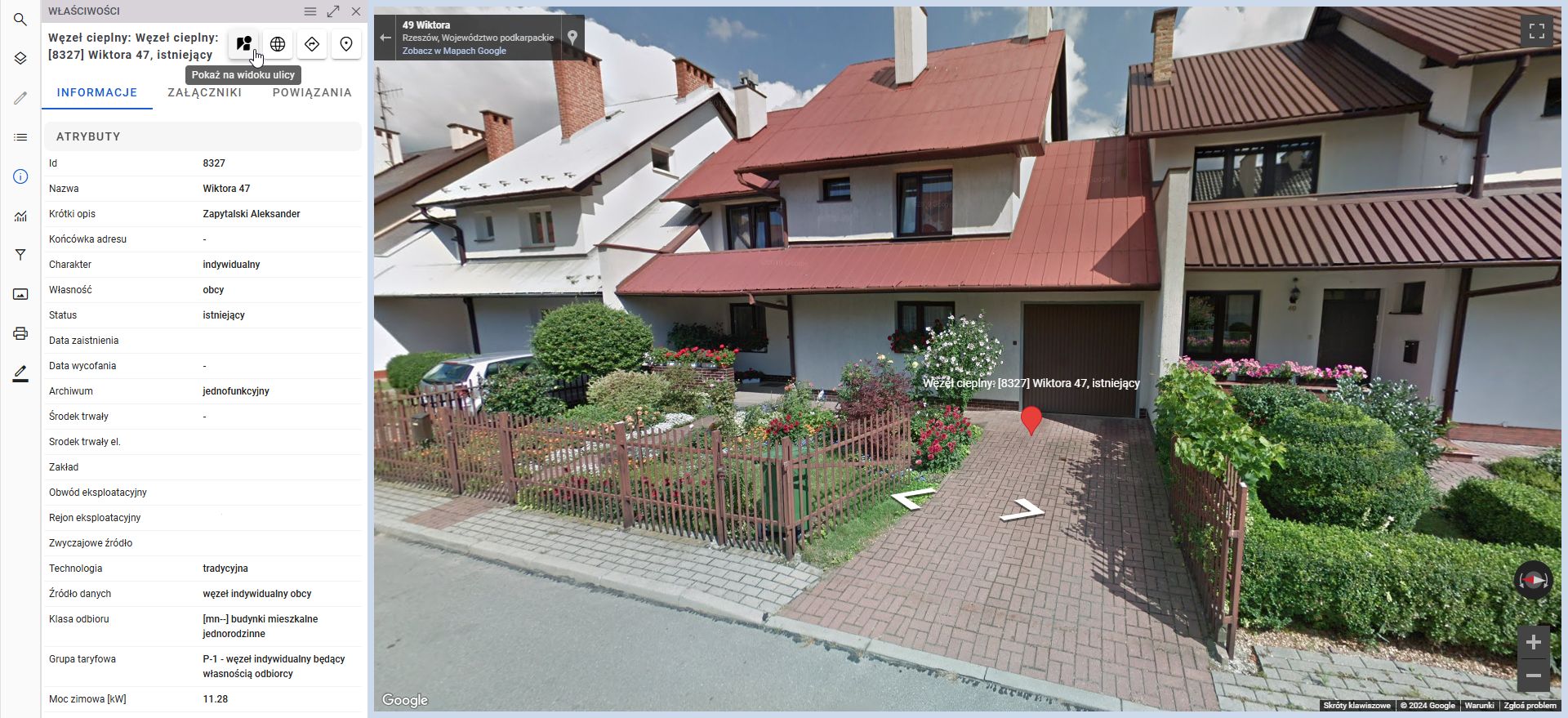
Street View: View the location of any selected object with Street View, accessible directly within GeoGrid.
Visualize your project’s surroundings with Google Street View integration in GeoGrid
Further Integration with FME Platform
You can now run FME scripts directly from the object properties panel in GeoGrid. Process and update object data with ease, generating reports or running transformations without switching between tools. This streamlined workflow saves time and ensures your data is always current.
Enhanced Visualization: Thematic Maps and Graphs
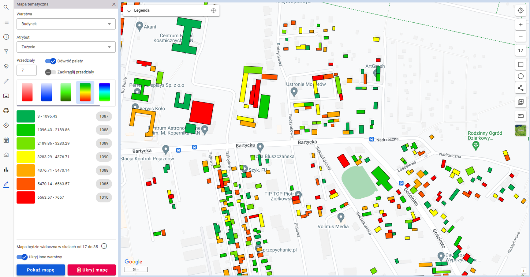
Thematic Maps: Create custom visualizations to showcase specific data attributes. For instance, energy usage in a building can be displayed by selecting layers, attributes, colors, and ranges.
You can choose between two types of graphs:
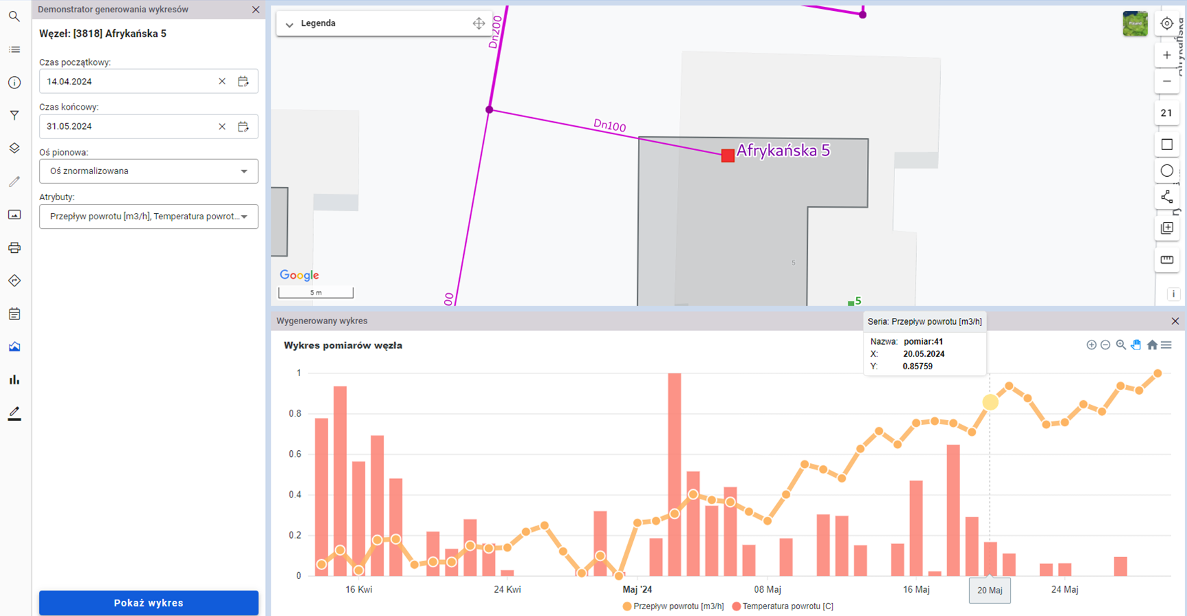
Time Graphs: Track how an attribute changes over time (e.g., temperature readings of a heat node).
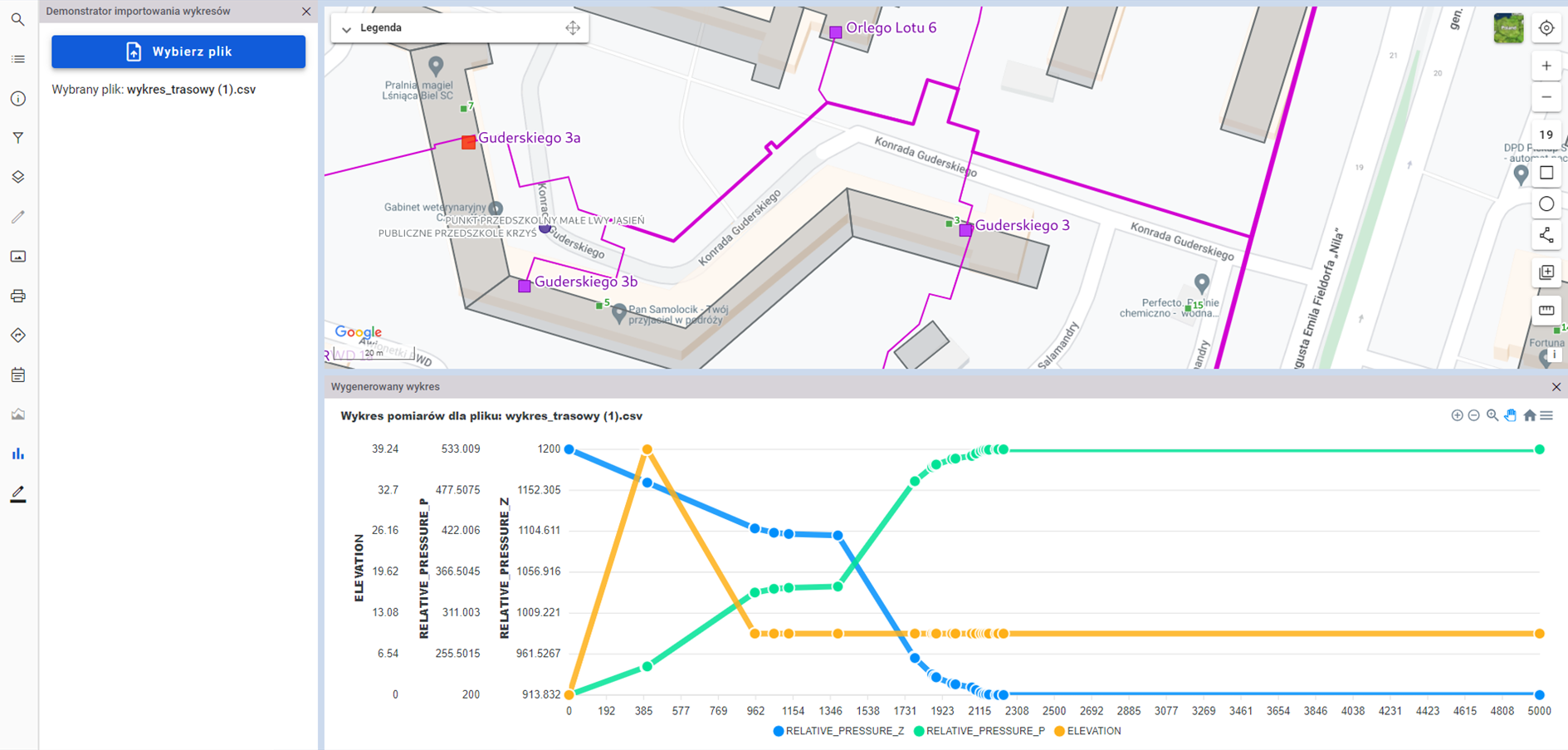
Route Graphs: Visualize spatial variability, such as cable heights or pressure levels along a pipeline.
A time graph comparing flow and return temperatures on a heat node over time
A route graph presenting pressure changes along a cable route
Automated Real-Time Updates
GeoGrid now supports automatic updates for dependent object data. For example, a telecom network project’s status will automatically change to “ready” once all included buildings are connected and operational.
This feature ensures your project statuses stay current, saving you time and effort.
Stay on top of your telecom investments with real-time updates on a map. Discover the FTTH Investment Tracker solution!
Strengthened Data Access Management
Collaboration just got easier and more secure. GeoGrid 1.6 introduces advanced data access management options. Set customized rules to control user permissions. For example, you can allow one user group to modify all building data while restricting another group to residential building information only. This way, you can keep your organizational data secure while enabling efficient collaboration.
Let’s Tackle Your Business Challenges Together!
Curious about how GeoGrid 1.6 can transform your business operations? We’d love to explore your specific challenges and demonstrate how GeoGrid can help.


