Did you know that Taxify, a ride-hailing platform founded in 2013, has been growing with Google Maps Premium Plan since its early startup stage? Today Taxify’s Google Maps based application is used by over 2,5 million customers and available in 18 countries (30 cities).
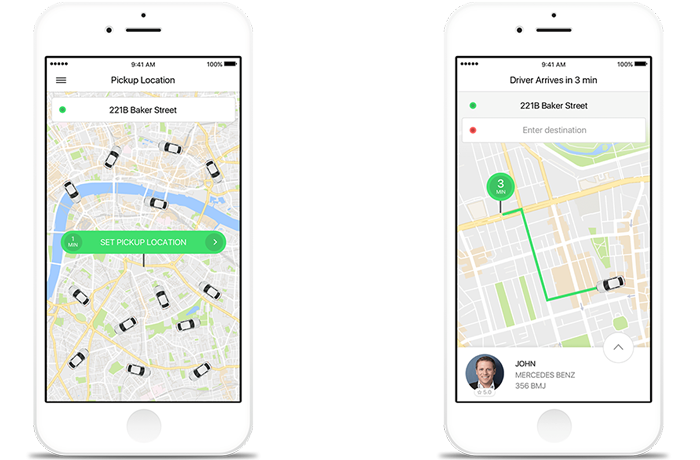
Taxify built a mobile appl for fast and easy rides booking. The solution is connected to a backend services consuming Google Maps API-s:
- Geocoding API is used to translate coordinates into a street addresse (the app finds your pickup location even if you don’t know your exact address)
- Places API to find nearby points of interests
- Directions API and Distance Matrix API are used for routing and determining estimated arrival time.
The company decided to build its app on top of Google Maps because of well-developed and easy to use API-s as well as high reliability and availability of the service.
Track your ride on Google Maps
How does it work? You can see available drivers on Google Maps and after choosing the most suitable one you can track live your ride’s location and its estimated arrival time.
Wondering if Google Maps can help grow your business? Contact us


